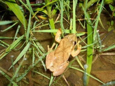
| Spring Peeper in the orchard |
|
SPECIES OF THE CAMP.
PEEPERS:Tree frogs found at the camp.Northern peepers sing from march to
june.Peepers can modify their color to match their surroundings,makeing them hard to see during the day.At night they will
freeze in a beam of light,look for the males who will be sitting on twigs or branches or in our case in the long grass in
the field in the orchard.They will stop singing if they sense footsteps.
History of the surrounding area..
The forests were unbroken, composed of pine, hemlock, maple, birch, ash, oak, cherry and other trees,
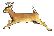
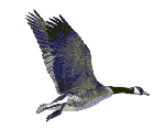
among which roamed the elk, the deer, panther, wolf and bear, and a great variety of smaller game. Wild turkeys and partridges
were common, and eagles, fishhawks, owls, henhawks, and an almost infinite variety of feathered songsters abounded. The creeks
were numerous; among the larger, Sand brook, emptying into the Coquago a mile above its mouth; Hawks or Cadocia, called also
May's brook; Reeds, Fish and Baxter brooks, tributary to the Pepacton; and Big Trout, Basket Pond, Geer's, Sand Pond, Lord's
and Holmes brooks, contribute to swell the Delaware below Shehocken. These streams, with many others, rush through the deep
gorges between steep and rocky hills, and were the resort of the finest trout and other fish.
This vicinity had been the center of an Indian union of tribes, according to their traditions, in very remote times.
They used to tell the early white settlers of a great battle that was fought between different nations of their race on the
plains by the river below Pepacton, which decided the fate of the confederacy adversely. There have been a great many Indian
arms -- arrows and spearheads of flint, tomahawks, etc. -- turned up by the plough on these flats, which seem to confirm the
legend .This paragraph describes the area below Pakataken wich would have been somewhere close to Downsville wich
is not to far away.
Just previous to the Revolution this county was inhabited by a few Indians, composed of remnants of the Wappinger,
Esopus, Lenni Lenape and Mohawk tribes; not withstanding the fact that they had conveyed the title to the king of Great Britain
in 1768.
Our property was part of a land patent granted by the King of England The first of these granted
was made to Johanus Hardenburgh and others, of the county of Ulster, on the twenty - third of April 1708. The defined limits
of this patent, now familiarly known as the Hardenburgh patent, were, owing to the unexplored state of the interior or western
part, vague and uncertain. An ancient settlement had been made at Minisink, on the Delaware - above which place no white settlement
existed. The idea of the source of the Delaware, or as it was then appellated, "Fish-kill," had been gathered from the friendly
Indians, who resided upon that stream, or from traders who had boldly penetrated into the wilderness to traffic with them.
From these sources of information it had been established that the source of the stream lay many days' journey to the north
- east, and hence the description in the original grant - "to the main branch of the Fish-kill or Delaware river;" whereas
the two streams are so evenly poised at their junction, that even the more practiced eye of the engineer, cannot without elaborate
investigation and computation, detect the larger.
Wooster, in the employ of the heirs of the Hardenbergh patentees, in 1749 surveyed the east branch of the
Delaware, then called the Fishkill, from the forks to its source; and the following year Robert Livingston surveyed the west
branch. Many of the monuments made by Wooster in 1749 were lost or could not be identified, and another survey was made by
Charles Webb in 1754. Webb divided the lands in the patent into great lots, about five miles.
It is not strange, then, that the question should at an early day be agitated, "which is the main branch of
the Delaware, or Delaware river proper?" and consequently the western limits of the Hardenburgh patent. It was urged by those
who assumed that the Hardenburgh title extended only to the East Branch, that it was so understood by the patentees themselves,
and that the original survey extended only to that boundary line. The facts relating to this controversy, so far as I have
been enabled to glean them, are these. In 1749, Ebenezer Wooster run up the East Branch, and the same year, or the succeeding,
Robert Livingston, also in the employ of the proprietors of the patent, surveyed and located the West Branch. The Indians,
who still held peaceable possession of the territory between the branches, either from a misunderstanding on their part, or
other motives, availed themselves of the technical misapprehension of the language of the instrument they had executed, and
protested in a body to the agents of the government, that the owners of the patent had reached beyond the limits of their
purchase, and were trespassing upon their territory. Hence it is obvious that while this matter remained unadjusted, the surveys
on the disputed part of the patent should have been suspended, while they were prosecuted upon the other sections. The final
result of these disputes between the patentees and Indians was a compromise on the part of the patentees, and the consummation
of a second purchase, as will appear by the following instrument:
"To all christian and other people whatsoever to whom these presents shall or may come or concern,
we Sandervatheverander, Anough, Hendrickhokeau, Swathekeen, Able, Renp, Shenck, Mounau, Jacobus, Mathesso, Benjamin, and others,
All lawful owners and proprietors of a certain tract or parcel of land lying in the county of Ulster and Albany; sendeth greetings:
know ye that the abovesaid Indians, for divers good causes, and considerations, them thereunto moving, but more and especially
for and in consideration of a certain sum of one hundred and forty - nine pounds, nineteen shillings, current money of the
colony of New York, to them or some of them, in hand paid, before the ensealing and delivering of these presents by Johanus
Hardenburgh, of Rosendall, in the county of Ulster, and province of New York, hath given, granted, bargained, sold, released,
ratified and confirmed unto the said Johanus Hardenburgh, all that certain tract or parcel of land, situate, lying and being,
between the Fish-kill and Papagonck river, in the county of Ulster and Albany. Beginning at the head of the Fish-kill, and
from thence running with direct line, to the head of Catricks-kill, and from the head of Catricks-kill with a direct line
to the head of Papagonck river, and thence down the east side of the said river Papagonck to a certain place called Shokakeen,
where the Papagonck river falls in the Fish-kill, and then up the said Fish-kill, including the same, to the head thereof
or the place of beginning, together with all the lands, hills and valley, mines and minerals, whatsoever, contained within
the bounds of the said tract of land, together with free fishing, fowling, hawking, hunting, and all other profits whatsoever.
To have and to hold the above said tract or parcel of land and premises, with the appurtenances thereunto belonging or in
anywise appertaining, unto him the said Johanus Hardenburgh, his heirs and assigns forever, and to the only proper use benefit
and behoof of him the said Johanus Hardenburgh, his heirs and assigns forever."
"In witness whereof, we the said Indians, have put our marks and seals, this third day of June, Anno Domini, one thousand
seven hundred and fifty-one."
"Signed by
"SUPPAU, JAN PALLING,"
"and twenty other Indian proprietors.
"Sealed and delivered in presence of
"EVERET WYNKOOP, and
"CORNELIUS ELMENENDORF."
The above deed was acknowledged on the third day of June, 1751, before A. Gaasbick Chambers, Judge of the Court of Common
Pleas of Ulster county. The receipt for the consideration expressed in the deed, is endorsed upon the back of the instrument.This
would be actually the second deed of our property since there was a dispute over wether or not the land between
the two branches of the Deleware was included in the Hardenburg patent.
|